Surface entry
The cenote starts quietly in the jungle. The surface can look calm and simple, which is part of the surprise.
Map & dive profile
Angelita is easy to describe badly: “it goes straight down.” That is true, but it misses the interesting part.
The dive is about layers: surface jungle, clear freshwater, the cloud zone, fallen trees, and darker water below. This page helps you understand the shape of the cenote before you get in.
Map illustration
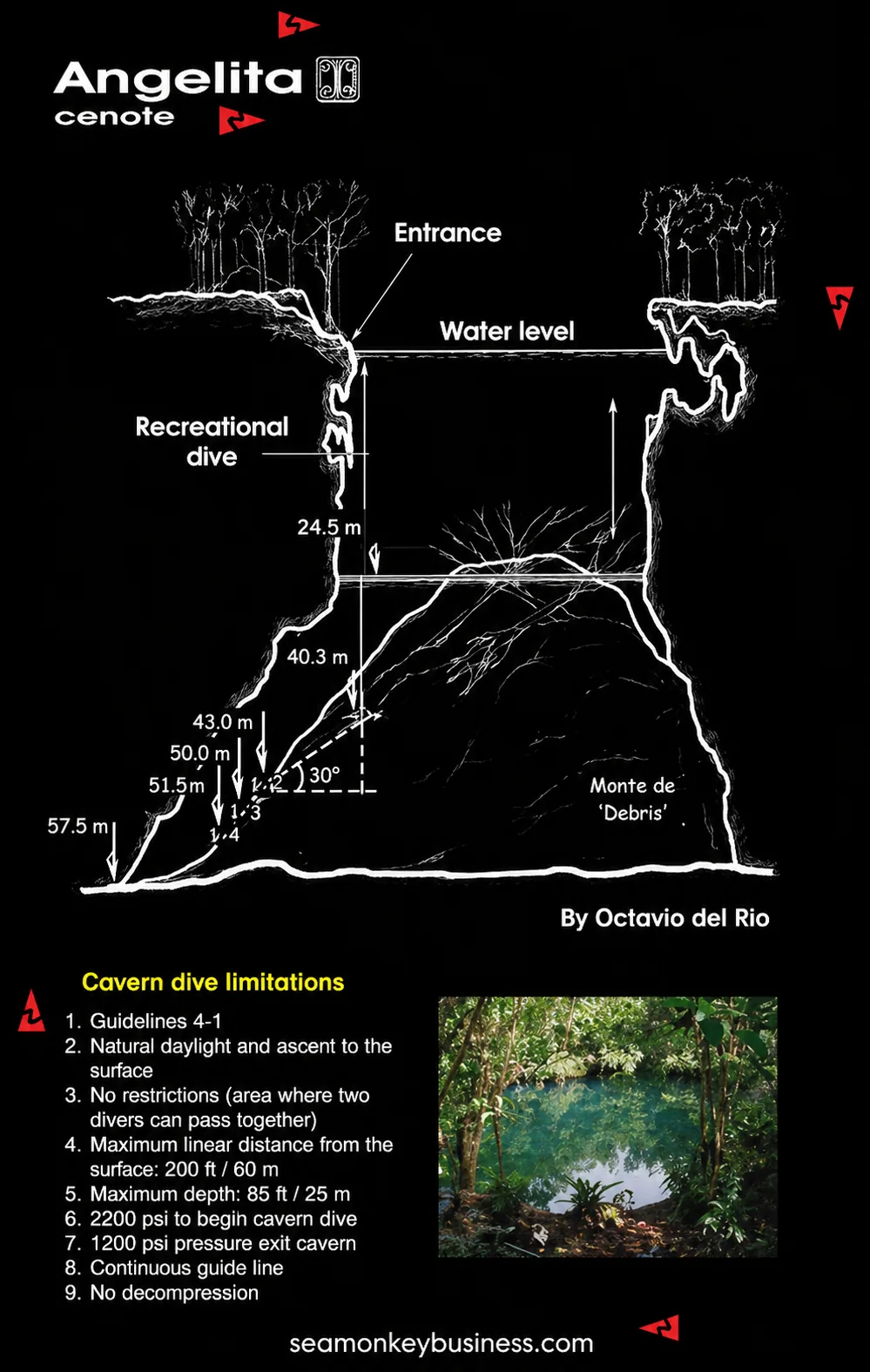
Depth profile
Exact conditions and visibility can vary. The profile is meant to explain the experience, not replace a guide briefing.
What the map shows
The cenote starts quietly in the jungle. The surface can look calm and simple, which is part of the surprise.
The upper part of the dive is clear freshwater. This is where you settle your buoyancy and descend slowly.
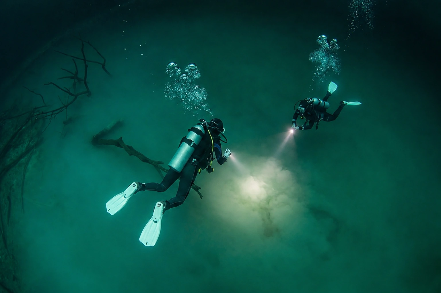
The hydrogen sulfide layer creates the famous cloud effect. This is the visual heart of Angelita.
Branches and trunks can appear through the cloud, giving the cenote its drowned-forest feeling.
Below the cloud, the dive becomes darker and more serious. This is where experience and discipline matter.
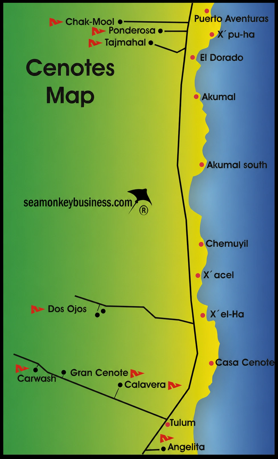
Where Angelita sits
Angelita is part of the wider Riviera Maya cenote world, but it has its own personality. It is commonly visited from Tulum or Playa del Carmen as a planned dive day, not as a quick roadside splash.
Regional map for broad orientation only. Drive times, access, and logistics should be confirmed when planning the tour.
What the map does not show
A map cannot show how you will feel at depth. It cannot show whether your buoyancy is calm, whether your ears are clearing easily, whether the group is relaxed, or whether conditions are perfect that day.
That is why Angelita should be guided properly. The map is useful. The briefing is essential.